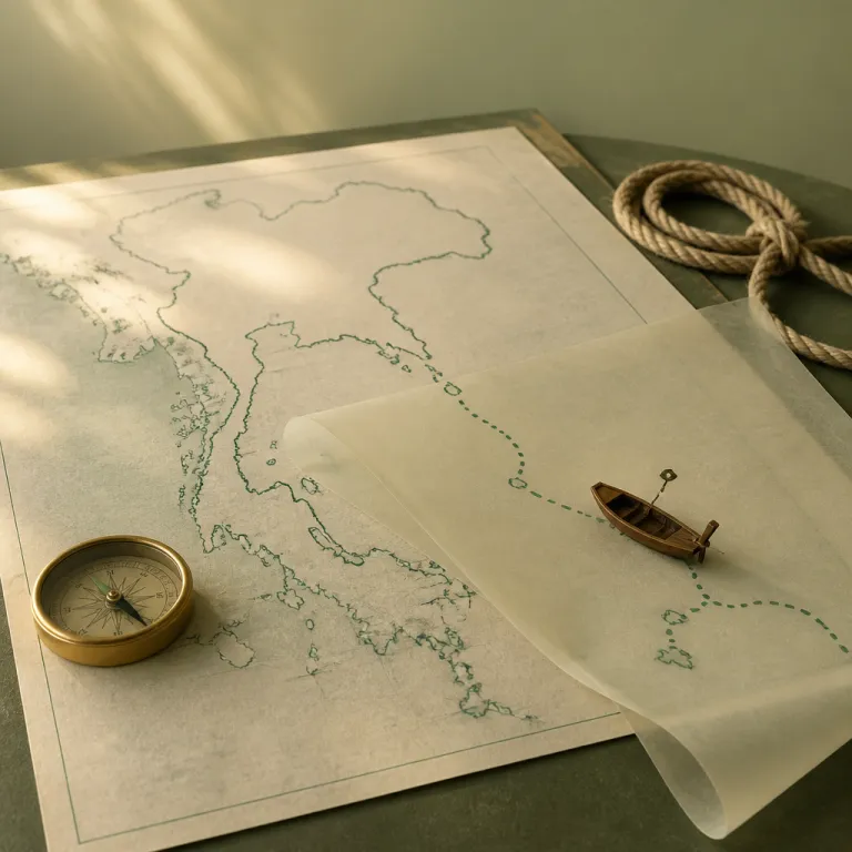
Reading a map of Thailand and islands before you land
A detailed map of Thailand and its islands is your most powerful planning tool. When you study a reliable Thailand map before flying, the geography of each island and stretch of coast starts to shape realistic routes. This early work turns vague Thailand travel dreams into a clear island-hopping trip with logical stages.
Begin with Bangkok, Thailand, on the map, because almost every international flight lands there. From Bangkok, trace the two main coasts that frame the Thai islands, then mark where the Andaman Sea lies to the west and where the Gulf of Thailand stretches to the east. This simple exercise helps you understand why some islands are linked by short ferry rides while others require domestic flights and overnight stays of several days.
On most tourist maps, the Andaman Sea side shows Phuket, Krabi, Koh Lanta, Koh Phi Phi and Koh Lipe aligned along the west coast. The opposite Gulf of Thailand side highlights Koh Samui, Koh Phangan, Koh Tao and Koh Chang scattered across the eastern islands. When you compare these regions on any good Thailand and islands overview, you immediately see that combining both coasts in one short trip often wastes precious days in transit.
Choosing between Andaman Sea and Gulf of Thailand routes
Every Thailand travel itinerary eventually faces one key decision about the islands. Do you focus your island-hopping trip on the Andaman Sea, or do you follow the Gulf of Thailand and its generally calmer waters? Your answer shapes not only which islands you visit, but also how many beaches you can enjoy in a limited number of days.
The Andaman Sea route usually starts with a flight from Bangkok to Phuket or Krabi, then continues by ferry to islands such as Koh Phi Phi, Koh Lanta and Koh Lipe. These islands offer some of the most dramatic beach scenery in Thailand, with limestone cliffs, turquoise bays and long white beaches that feel cinematic. If you study any Thailand tourist map, you will notice that the distances between these Andaman islands are relatively short, which allows you to change island almost every day if you wish.
The Gulf of Thailand route often begins with a flight from Bangkok to Surat Thani or a direct flight to Koh Samui, followed by ferry links to Koh Phangan and Koh Tao. This side of Thailand is ideal for travelers who prefer slightly calmer seas, sheltered beaches and a mix of nightlife and quiet coves. When you compare both coasts on a map of Thailand and its islands, the Andaman Sea excels for rugged scenery while the Gulf of Thailand is better for more predictable conditions and smoother ferry operations.
Designing an island hopping itinerary from Bangkok
Bangkok is the natural starting point for almost every Thailand travel plan. The city sits in central Thailand, and its airports connect efficiently to both the Andaman Sea and the Gulf of Thailand coasts. When you open a tourist map that shows Bangkok together with the islands, you can quickly sketch several realistic routes that match your available days.
For a one-week trip focused on the Andaman side, many Thailand trip planners recommend flying from Bangkok to Phuket, then using ferries to reach Koh Phi Phi and Koh Lanta. This route offers a balanced mix of lively beaches near Phuket and quieter stretches of sand on each smaller island further south. If you have more days, you can extend the line on your map to Koh Lipe near the Malaysian border, which often appears at the very bottom of any detailed Thailand and islands chart.
For a Gulf of Thailand itinerary, a classic route links Koh Samui, Koh Phangan and Koh Tao in a gentle arc across the sea. You might spend one day exploring Samui’s accessible beaches, then several days on Koh Phangan’s quieter coast before ending on Koh Tao for snorkeling and diving. When you compare this chain with an Andaman route on a Thailand map, you see that the Gulf cluster is more compact, which reduces travel time and makes it easier to settle into a slower rhythm.
Understanding ferry routes, flight links and realistic travel times
Island hopping in Thailand looks effortless on a flat map, but real travel times can surprise first-time visitors. Distances between islands may seem short, yet ferry schedules, check-in procedures and weather delays can easily consume half a day. This is why reading the small print on any tourist map and cross-checking with current ferry timetables is essential.
On the Andaman Sea side, common ferry routes connect Phuket to Koh Phi Phi (around 2 hours), Koh Phi Phi to Koh Lanta (about 1.5–2 hours) and Koh Lanta to Koh Lipe (roughly 3–4 hours) in a logical southbound chain. Each leg may only take a few hours, but you must add transfer time from your beach accommodation to the pier and from the arrival pier to your next hotel. When planning a trip of ten days or less, limit yourself to three main islands on this coast, so that you spend more time on beaches and less time waiting for boats.
In the Gulf of Thailand, ferries and high-speed catamarans link the trio of Koh Samui, Koh Phangan and Koh Tao with frequent departures. Typical crossings range from about 30–90 minutes between Samui and Phangan and 1.5–3 hours between Samui or Phangan and Koh Tao, depending on the operator and sea conditions. Always remember that even the best planned Thailand and islands itinerary can be disrupted by storms, so allow flexible days in your schedule and avoid booking last-minute flights from small islands back to Bangkok on the same day as your international departure.
Matching islands to travel styles, from quiet coves to lively beaches
Each island in Thailand has a distinct personality that rarely appears on a simple map. To choose the best route, you must match your travel style with the character of each island and its beaches. This is where a detailed tourist map, combined with honest trip reports, becomes more valuable than any glossy brochure.
Phuket and Koh Samui suit travelers who want a wide choice of restaurants, organized excursions and easy transport connections. On a Thailand and islands overview, these two appear as major hubs, with multiple ferry lines radiating toward smaller islands such as Koh Phi Phi, Koh Lanta, Koh Phangan and Koh Tao. In contrast, Koh Chang and Koh Lipe attract visitors seeking quieter beaches, fewer crowds and a slower rhythm, which you can sense by the limited number of ferry routes drawn to each coast.
For culture-focused Thailand travel, consider combining Bangkok with Chiang Mai on the mainland before flying to the coast. This pairing allows you to experience temples and markets inland, then unwind on beaches along either the Andaman Sea or the Gulf of Thailand. Careful map reading helps you link these regions into one coherent journey instead of scattering your time across too many distant islands.
Practical planning tips using a map of Thailand and islands
Effective island hopping begins with a realistic look at distances and seasons on a detailed map. Thailand’s Tourism Authority notes that the country has about 1,430 islands, which means no single trip can cover more than a small fraction. When you accept this, you can focus your Thailand travel on one coherent cluster of islands instead of chasing every famous beach name.
Always check how many days you truly have between your arrival in Bangkok and your departure flight home. Use a Thailand map to block out your first and last nights in Bangkok, then allocate the remaining days to no more than three islands on one coast. The Tourism Authority of Thailand and local tour operators often remind visitors to “Check weather forecasts. Book accommodations in advance. Respect local customs.”, advice that becomes even more relevant when you move between islands by ferry.
When planning your route, consult both a printed tourist map and online tools that show current ferry and flight options. Mark key hubs such as Phuket, Krabi, Koh Samui and Chiang Mai, then draw simple lines to nearby islands like Koh Phangan, Koh Tao, Koh Chang, Koh Lanta, Koh Phi Phi and Koh Lipe. This visual approach turns the abstract phrase “map of Thailand and islands” into a practical navigation aid that helps every Thailand tourist build a safe, elegant and memorable island-hopping journey.
Key figures for island hopping in Thailand
- Thailand counts around 1,430 islands according to the Tourism Authority of Thailand, which means travelers must carefully select a small group of islands for each trip instead of trying to visit many scattered locations.
- Thailand welcomed approximately 39.8 million international tourists in 2019 according to World Bank data, highlighting how important it is to book ferries and coastal accommodation early during peak season on both the Andaman Sea and Gulf of Thailand coasts.
- Peak season for most Thai islands generally runs from November to February, while the off-peak period from March to October often brings lower prices but a higher risk of storms that can disrupt ferry schedules and day trips.
- Bangkok sits at approximately 13.7563° N and 100.5018° E in central Thailand, making it the primary aviation hub from which most travelers connect to Phuket, Krabi, Koh Samui or Chiang Mai before continuing toward island-hopping routes.
FAQ about using a map of Thailand and islands
What are the top islands to visit in Thailand for a first trip?
For a first-time visit, many travelers choose Phuket, Koh Samui, Koh Phi Phi and Koh Tao because they combine accessible transport, varied beaches and a wide range of services. These islands appear clearly on every Thailand map and are well connected by flights and ferries. They also offer a good balance between lively areas and quieter stretches of coast.
When is the best time to visit Thailand’s islands for beach weather?
The most reliable beach weather on both the Andaman Sea and Gulf of Thailand coasts usually occurs from November to February. During these months, seas are calmer, skies are clearer and ferry operations are more predictable. Off-peak months can still be rewarding, but travelers should expect occasional storms and plan flexible days.
Do I need a visa to travel around Thailand’s islands?
Visa requirements for Thailand depend on your nationality and length of stay. Many countries benefit from visa exemptions for short tourist visits, which makes island hopping easier for typical trips of a few weeks. Always check the latest information from official Thai government or embassy sources before booking flights.
How many islands can I realistically visit in one Thailand trip?
For a two-week holiday that includes time in Bangkok, most travelers comfortably visit two or three islands on a single coast. Trying to combine both the Andaman Sea and Gulf of Thailand in one short itinerary often leads to rushed transfers and less time on the beach. A focused route built around a clear Thailand and islands plan usually delivers a more relaxed experience.
What tools should I use alongside a tourist map when planning?
A printed tourist map of Thailand and its islands is an excellent starting point, but it should be paired with online maps, airline websites and ferry booking platforms. These digital tools provide current schedules and travel times that a static map cannot show. Local travel agencies and hotel concierges can then help refine your route based on recent weather and sea conditions.