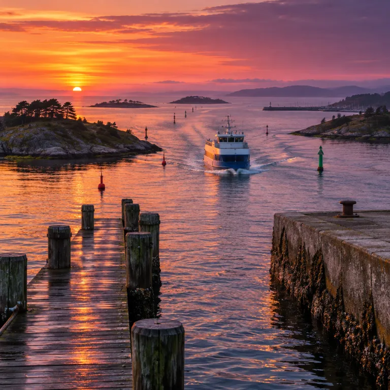
How new ferry routes quietly redraw island hopping maps
New ferry routes and upgraded island connectivity rarely make front-page travel news. Yet a single additional sailing can compress a two-day island detour into one precise morning crossing that transforms how you plan every coastal itinerary. For a business-leisure traveller used to reading a transit timetable, the real luxury is often the extra island you can now fit between two meetings in a nearby city.
Think of how the NYC Ferry network reframed the mental map of New York City for locals and visitors. When the East River and South Brooklyn routes launched in May 2017, Staten Island was no longer just a distant terminal at the edge of the harbour, and south Brooklyn suddenly felt like a string of coastal villages stitched together by a modern ferry system. The same logic applies in the Mediterranean or the Baltic, where a new island ferry can turn a forgotten harbour into the natural hub for a whole archipelago.
Once you start tracking timetable changes, you see patterns repeat from region to region. A fresh island route often links a working port on the east side of a main island with a quieter bay on the west of another, echoing how Wall Street now connects by water to the relaxed piers of Sunset Park. In Greece, for example, the Blue Star Ferries link between Piraeus, Syros and Tinos shortened what used to be an awkward overnight shuffle; Blue Star’s regular departures now make it realistic to leave Piraeus after work and wake up in the Cyclades. In Finland, new summer sailings between Hanko and Bengtskär lighthouse have turned a remote rock into a realistic day trip, with departures clustered in the main season rather than scattered across the calendar. The most interesting island hopping itineraries usually follow these early connections, before the crowds and the real estate agents fully catch up.
From two-day detours to morning crossings
The most powerful shift happens when a new route removes the need to backtrack through a mainland city. In island chains where travellers once had to return to a central transit terminal, a direct ferry service between two secondary islands can save a full day and a half. That is the difference between a rushed overnight and a measured stay long enough to feel the rhythm of the harbour street at dawn.
Concrete examples make this easier to see. In Croatia, the Jadrolinija catamaran that links Split, Hvar and Korčula lets you move south through the Dalmatian islands without returning to the mainland between each hop; on busy summer days, multiple sailings turn what was once a slow detour into a straightforward island corridor. In Scotland’s Inner Hebrides, Caledonian MacBrayne’s Oban–Coll–Tiree sailings effectively turn three separate islands into one coherent island hopping route, with a timetable that allows you to step off on one island and rejoin the same vessel later in the week. When a coastal authority quietly adds a seasonal link like these, it often signals confidence that travellers will treat those islands as a single, navigable cluster.
For travellers who like to be ahead of the curve, this is where planning becomes an art. Study updated ferry maps and island networks the way a local executive studies a detailed transit diagram, and you will see where tomorrow’s most fluid itineraries will emerge. If you enjoy combining sailing with scheduled links, pairing a structured learn to sail vacation in open waters with well-timed ferries can turn a simple trip into a layered, multi-island journey.
Winners, losers and the character of an island
Every new ferry line creates winners and losers across an archipelago. The island that gains a direct ferry service from a major city often sees its harbour street fill with new cafés, while a neighbouring island without a terminal quietly preserves its slower tempo. For travellers who value character as much as convenience, the art lies in using the new access without letting it dictate every overnight stop.
Again, the example of New York City is instructive. When routes were announced to Governors Island, Roosevelt Island and Coney Island, each island’s role in the wider ferry system shifted, just as a quiet fishing harbour changes once it becomes the first stop on a new island route. Similar patterns appear elsewhere: when the Piraeus–Aegina–Agistri triangle in the Saronic Gulf gained more frequent hydrofoil departures, Aegina’s waterfront filled with weekend visitors while Agistri stayed comparatively low-key; in Norway’s Lofoten, extra summer sailings between Bodø, Moskenes and Reine brought more hikers to one village while leaving another almost unchanged. Some places lean into the change, building waterfront parks and promenades, while others protect working quays and limit new development to keep the balance right.
As you plan, read new ferry links as both opportunity and warning. The most rewarding itineraries often pair a well-served hub, equivalent to a busy East River terminal, with a second island that still feels like a detour even when the timetable says otherwise. Shared experiences on the water, such as carefully guided giant SUP adventures between nearby coves, can help you feel the seascape beyond the timetable and remind you why you almost missed the ferry because you were not ready to leave.
How to read a timetable like an island insider
Planning serious island hopping starts with reading a timetable the way a commuter reads the NYC Ferry grid. Look for where a new island ferry quietly links two lines that previously ended in separate corners of the map, much as an unexpected East River connection can suddenly make an east side neighbourhood feel close to a distant park. These subtle joins often mark the future backbone of an archipelago itinerary.
A simple mental sketch can help. Imagine three circles in a row, labelled “City”, “Hub Island” and “Quiet Island”. If the only line runs City–Hub and back, the quiet island stays theoretical. As soon as a short Hub–Quiet shuttle appears on the timetable, the diagram turns into a triangle and a realistic two-night loop. When a coastal authority or private operator announces new routes that connect a working harbour with a leisure-focused bay, it usually means they expect enough year-round demand to justify the ferry service beyond summer weekends. In practice, that can turn a sleepy quay into the equivalent of a south Brooklyn pier, with early-morning departures that suit both residents and time-pressed visitors.
For the business-leisure traveller, this is where strategy meets pleasure. Study evolving route maps and island connectivity with the same attention you might give to a complex transit diagram in a financial district, and you will see where to add one extra night to unlock three extra islands. A practical checklist helps: confirm whether the new line runs daily or only on select days, note first and last departures, sketch your City–Hub–Quiet triangle on paper, and then test at least one alternative loop so that a cancelled sailing does not unravel the whole plan.
Seasonal links, year-round lines and timing your hop
Not all ferry routes are created equal, and the timetable tells you more than just departure times. A year-round island route usually signals a resident community and reliable daily rhythms, while a purely seasonal ferry service often points to a place that feels very different once the last boat of the season leaves. Understanding this distinction is essential when you are stretching a work trip into a carefully planned island hopping escape.
Urban networks again offer a useful lens. In New York City, the NYC Ferry lines that operate beyond peak summer weekends support commuters from Staten Island, south Brooklyn and other waterfront districts, while more seasonal links to leisure-focused piers feel closer to classic island ferry operations. In the Balearic Islands, year-round Balearia and Trasmed crossings between Palma, Ibiza and Formentera underpin local life, while extra summer-only fast ferries simply layer on top. When you see a coastal timetable that mirrors this pattern, you can safely assume that the year-round routes will be more resilient to weather and operational changes.
For travellers who plan by the timetable, new ferry routes and island connectivity are as important as any hotel opening. A freshly announced line that runs only on certain days can still be the key to unlocking a chain of islands, provided you are willing to let the schedule shape your movements. The most satisfying itineraries often emerge when you accept that the ferry, not the clock on your phone, sets the pace of the journey.
FAQ
How can I spot a new ferry route that will change my itinerary
Look for routes that connect two islands which previously required a mainland detour, or that link different parts of an existing network into a continuous chain. Check recent timetable updates from major operators such as Blue Star Ferries in Greece, Jadrolinija in Croatia or Caledonian MacBrayne in Scotland, and compare them with last year’s schedules. When an operator quietly adds a direct line between a working harbour and a leisure-focused bay, it often signals that the region expects more multi-island travel and that you can now replace a long transfer with a single, well-timed crossing.
Should I prioritise year-round ferry lines or seasonal services
Year-round lines usually offer more reliability and indicate a resident community, which suits travellers who value everyday rhythm and dependable departures. Seasonal services can unlock otherwise remote islands, but they demand more careful planning and flexibility if weather or demand changes. A balanced itinerary often uses a year-round spine with one or two seasonal branches, so that if a summer-only link is cancelled you can still fall back on the permanent route and adjust your overnight stops rather than abandon the trip.
How early should I book ferries for a multi-island trip
On popular routes and during peak holiday periods, booking several weeks ahead is prudent, especially if you are travelling with a vehicle. For shoulder seasons or less frequented lines, a few days’ notice is often enough, though last-minute changes can still affect smaller vessels. Always check whether your ticket is tied to a specific departure or valid for a broader time window, and set calendar reminders for release dates on high-demand routes so you can secure the exact sailings that make your island sequence work.
What is the best way to research island connectivity before I travel
Start with official ferry operator websites and regional transport authorities, then cross-check with recent traveller reports and local tourism offices. Studying schematic network maps helps you see how individual lines combine into realistic island hopping corridors. For complex archipelagos, specialist guides that focus on cycling or sailing between islands can provide route-level insight that generic travel overviews rarely match, and plotting a simple diagram of your own on paper often reveals where one extra link could save you an entire day.
How do urban ferry systems help me plan open-water island hopping
Urban systems such as the NYC Ferry network show how new links change perceived distance and create fresh neighbourhood pairings, which mirrors what happens when islands gain new connections. By observing how locals adapt to new routes in a city — for example, shifting commutes to the South Brooklyn line once it opened — you learn to anticipate which islands will become natural hubs once a new line appears offshore. This mindset helps you design itineraries that feel intuitive on the water, not just efficient on paper, and encourages you to treat each timetable update as a chance to redraw your personal island map.