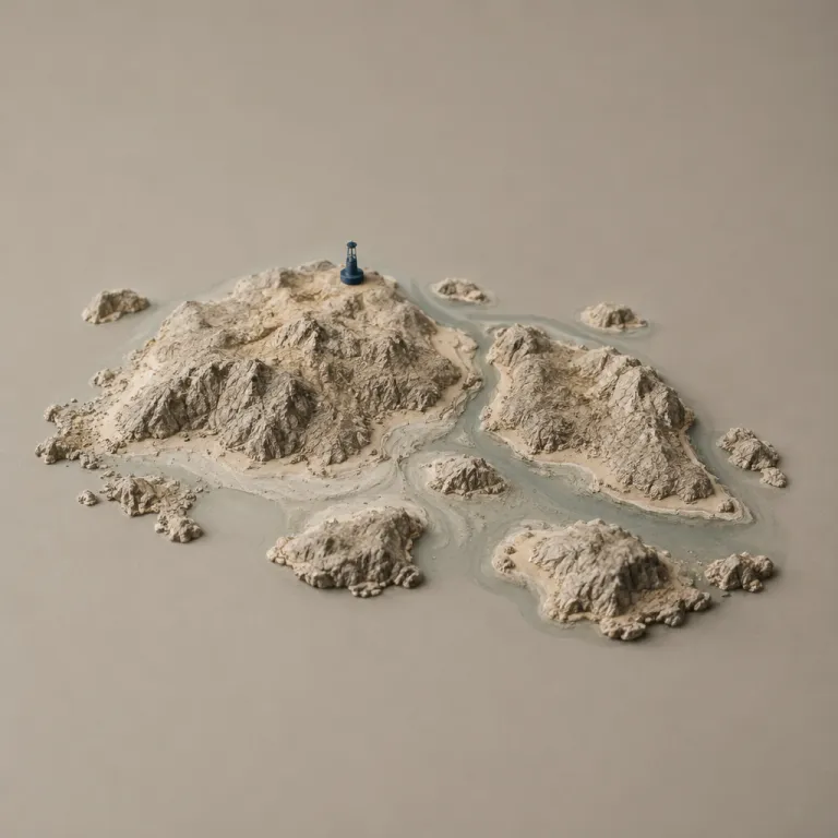
Understanding where the Beevitius islands are said to be
Travellers researching where the so‑called Beevitius islands are usually expect a clear geographic answer on a map. Many island‑hopping enthusiasts imagine the Beevitius island group as a remote tropical archipelago somewhere between the Virgin Islands, Fiji, and Vanuatu, yet no such island appears in any recognised nautical chart or official gazetteer. When you ask where Beevitius is located on a map, you quickly enter a grey zone between online myth, mislabelled maps, and unverified travel stories that never provide coordinates.
On any modern map produced by recognised cartographic agencies or national hydrographic offices, there is no official reference to a Beevitius island or to Beevitius islands as a named archipelago. Searches in public catalogues from the United Kingdom Hydrographic Office, in Admiralty chart indexes, and in the GEOnet Names Server return no island with the Beevitius name. The question “where Beevitius might be located” usually leads to secondary blogs, reposted images, or low‑authority travel pages rather than to national hydrographic offices or respected atlases, which is a strong sign that the place is unverified.
When you compare this situation with the clearly documented location of the British Virgin Islands or the precise coordinates of Fiji–Vanuatu routes, the contrast is striking. Every recognised island in the BVI has coordinates, port information, and safety notes, while Beevitius islands remain entirely absent from any comparable registry or official map. For travellers who want to learn how to evaluate a mysterious island name, the case of Beevitius offers a valuable lesson in reading between the lines of online content and recognising when an island location is not supported by authoritative geographic data.
How the Beevitius islands myth spread across travel media
The phrase “where is Beevitius islands” did not emerge from hydrographic surveys or maritime logs. It appears to have grown through repetition on smaller travel blogs, reposted social media images, and occasional mentions on sites that aggregate content without rigorous travel safety research. Some pages even reference Beevitius islands near the Virgin Islands or close to Fiji–Vanuatu routes, yet they provide no coordinates, port details, or verifiable photographs of any single Beevitius island, which is a clear warning sign for anyone relying on those sources.
In some cases, the name Beevitius has been loosely associated with business or entrepreneurship platforms such as Tycoonstory or Tycoonstory Media, where travel‑themed anecdotes sometimes mix with lifestyle content. When a travel story is framed more as a motivational tale than as a geographic guide, the location of the islands often becomes a decorative detail rather than a documented fact on a map. That is one reason why an island‑hopping enthusiast must learn to separate narrative flair from official geographic information when reading about any remote archipelago or supposed hidden place.
Reputable travel information providers such as National Geographic, data‑driven databases similar to Geographic Expedia, or the tourism boards of the British Virgin Islands never list Beevitius among their destinations. Instead, they focus on real islands like Tortola, Virgin Gorda, Anegada, or Jost Van Dyke, each with clear maps, coordinates, and safety notes. When a name such as Beevitius appears only in unverified corners of the web and never in these authoritative sources, that absence is itself a meaningful sign for any careful island hopper evaluating where an island is actually located.
Comparing Beevitius myths with real island hopping routes
When travellers ask where Beevitius islands might be, they often imagine a secret chain hidden between better‑known archipelagos. In reality, the most rewarding island‑hopping routes still follow charted islands such as the Virgin Islands, the British Virgin Islands, and the South Pacific groups around Fiji and Vanuatu. Each real island in these regions has a defined location, port infrastructure, and reliable safety information that serious sailors and ferry operators use every day, which is the opposite of the vague descriptions attached to Beevitius.
For example, when you sail through the BVI, you move between Tortola, Virgin Gorda, Jost Van Dyke, and smaller cays that all appear on every nautical map with precise coordinates. The same applies when you plan a route between Fiji and Vanuatu, where inter‑island ferries and domestic flights connect real communities across a vast oceanic archipelago that is fully documented in official charts. None of these official charts or schedules ever mention a Beevitius island, which reinforces the view that Beevitius islands belong to online fiction rather than to the real geography of island hopping.
Travellers who enjoy remote island narratives sometimes compare the Beevitius story with more grounded experiences such as visiting the lighthouse islands off Brittany’s wild coast. When you read about lighthouse islands off Brittany, you see precise distances, ferry times, and safety notes that reflect genuine travel safety research and verifiable geographic data. That level of detail is exactly what is missing whenever someone writes about where Beevitius islands are supposedly located, and that contrast helps you evaluate which island‑hopping stories can guide real itineraries and which remain unverified myths.
How to verify where an island is before planning a route
Anyone intrigued by the phrase “where is Beevitius islands” can use the same verification steps that professional travel journalists apply to any remote island. The first step is to check whether the name appears in recognised databases such as national hydrographic offices, Admiralty charts from the UK Hydrographic Office, the GEOnet Names Server, or respected atlases used by National Geographic‑style publications. If an archipelago name such as Beevitius islands appears only on casual blogs and never in these official references, you should treat its location as unverified and avoid plotting it on your route map.
The second step is to compare the supposed place with nearby, well‑documented islands such as the Virgin Islands, Virgin Gorda, or Jost Van Dyke in the BVI. Each of these real islands has port authorities, tourism offices, and safety advisories that you can contact directly to learn about ferry routes, anchorages, and seasonal conditions. When you cannot find any such contact for a name like Beevitius, or any official mention in British Virgin Islands registries, that absence is another strong sign that the island group does not exist in the way some online stories suggest.
A third step is to cross‑check travel narratives with structured itineraries such as elegant rail‑to‑coast journeys that end in real island hubs. When you read about an elegant route into Scotland’s island heart, every station, ferry, and place is mapped and ticketed, leaving no doubt about where each island is located and how to reach it. Applying that same scrutiny to the question of where Beevitius might be quickly reveals that Beevitius islands lack the infrastructure, schedules, and official recognition that define real island‑hopping destinations in regions like Fiji–Vanuatu or the Virgin Islands.
Reading signs of credibility in island hopping content
When you search for where the Beevitius islands are, the most important skill is learning to read the subtle signs of credibility in every article. Reliable guides to the Virgin Islands or to the Fiji–Vanuatu region usually state distances in kilometres, mention harbour depths in metres, and reference recognised authorities such as coast guards or meteorological services. By contrast, many pages that mention Beevitius islands rely on vague phrases, recycled images, and no concrete data about the location of any single island, which is a clear sign that the information is not grounded in official sources.
Look for whether an article situates an island within a known archipelago, such as the British Virgin Islands or the chain between Fiji and Vanuatu, and whether it names nearby ports or channels. If a text claims that Beevitius lies near the BVI yet never mentions Tortola, Virgin Gorda, or Jost Van Dyke, that gap should raise questions about its geographic accuracy and about where the island is supposed to be on a map. The same applies if a story places Beevitius between Fiji and Vanuatu without referencing real ports such as Suva or Port Vila, which every serious island‑hopping route must pass through.
Another strong indicator is whether the content reflects genuine travel safety research or simply repeats a romanticised myth. Guides that reference organisations similar to National Geographic or data‑driven platforms comparable to Geographic Expedia tend to anchor their advice in verifiable facts, coordinates, and official notices. When a page about where Beevitius might be located offers none of that grounding, you can safely treat Beevitius islands as a narrative device rather than as a destination for your next voyage or a real place in any recognised archipelago.
Choosing real hidden gems instead of unverified islands
The fascination with the phrase “where is Beevitius islands” reflects a deeper desire for hidden gems in the world of island hopping. Rather than chasing an unverified Beevitius island, you can focus on lesser‑known corners of real archipelagos such as the quieter bays of the British Virgin Islands or the outer islands of Fiji and Vanuatu. Each of these places offers authentic culture, measurable distances, and reliable safety information that you can integrate into a serious itinerary without relying on unverified map references.
In the BVI, for example, sailing between Virgin Gorda, Jost Van Dyke, and smaller cays allows you to experience the same sense of remoteness that some travellers seek when they ask where Beevitius might be. The difference is that every anchorage, reef, and channel in this archipelago appears on an official map, supported by coast‑guard notices and harbour‑master updates from British Virgin Islands authorities. That combination of remoteness and documented location is what defines a true hidden gem for experienced island hoppers who value both adventure and accurate geographic information.
If you enjoy the idea of mysterious islands, you can channel that curiosity into well‑researched routes such as journeys to remote lighthouse islands or rugged Atlantic outposts. Reading in‑depth features on wild lighthouse archipelagos will help you learn how professionals frame real geography while still evoking a sense of wonder and place. By applying the same critical lens to every mention of Beevitius islands, you protect your time, your budget, and your safety while still embracing the romance of island hopping and learning how to distinguish real islands from unverified names.
Key figures and data points for evaluating island hopping destinations
- According to public catalogues from the United Kingdom Hydrographic Office and Admiralty charts, more than 1,000 named islands and rocks appear on official charts of the wider Caribbean, yet none carry the name Beevitius, which confirms that Beevitius islands are not part of any recognised registry or official map series.
- Tourism authorities for the British Virgin Islands report that sailing and yacht charters account for a significant share of arrivals, with visitors typically combining three to six island stops per trip, illustrating how real archipelagos support structured island‑hopping routes with documented locations and ports.
- In the South Pacific, the Fiji archipelago includes more than 300 islands, while Vanuatu comprises over 80 islands, all documented with coordinates and port information in official hydrographic data, which stands in sharp contrast to the entirely unverified status of any supposed Beevitius island.
- Safety advisories from maritime authorities emphasise that uncharted reefs and unnamed islands significantly increase navigation risks, which is why experienced sailors rely on recognised charts and official notices rather than on anecdotal references to places such as Beevitius islands or other unverified locations.
FAQ about Beevitius islands and island hopping research
Where is Beevitius islands located on the map?
No recognised map from national hydrographic offices, Admiralty chart catalogues, or major atlases shows any location for Beevitius islands. When travellers ask where Beevitius might be, they usually find only unverified online mentions rather than coordinates or charts. That absence of official data indicates that Beevitius is not a real, charted archipelago and should not be treated as a confirmed place.
Are Beevitius islands part of the British Virgin Islands or the Virgin Islands?
The British Virgin Islands and the wider Virgin Islands region are well documented, and none of their islands carry the name Beevitius. Every recognised island in the BVI, such as Tortola, Virgin Gorda, and Jost Van Dyke, appears in official registries and nautical charts with clear coordinates. Beevitius islands do not appear in any of those official sources, which confirms that they are not part of the British Virgin Islands archipelago.
Why do some travel sites mention Beevitius islands?
Some smaller sites and content aggregators repeat the phrase “where is Beevitius islands” without conducting thorough travel safety research or checking official geographic data. In certain cases, the name appears alongside lifestyle or business content on platforms similar to Tycoonstory Media, where geographic accuracy is not the primary focus. Because these mentions are unverified and lack coordinates or official confirmation, they should not be used for planning real island‑hopping routes.
How can I learn whether a mysterious island is real before travelling?
To learn whether an island is real, start by checking official charts, tourism boards, and respected publishers such as National Geographic or data‑driven platforms comparable to Geographic Expedia. Confirm that the island’s location appears consistently across multiple authoritative sources and that there are ports, transport links, and safety advisories you can verify. If those elements are missing and the name appears only in unverified blogs, treat the island name as unconfirmed and avoid basing travel plans on it.
What are safer alternatives to chasing unverified islands like Beevitius?
Instead of pursuing unverified places such as Beevitius islands, focus on lesser‑known corners of real archipelagos like the outer islands of the British Virgin Islands or remote parts of Fiji and Vanuatu. These destinations offer the same sense of exploration while providing clear location data, transport options, and safety information from official sources. That balance of remoteness and documentation is ideal for responsible island hopping and helps you learn how to distinguish real islands from online myths.